Trail Rides
See even more trail maps
There are a bunch of trails for easy and more challenging rides. Below are a few that we like, and be sure to go to our facebook page to see even more.
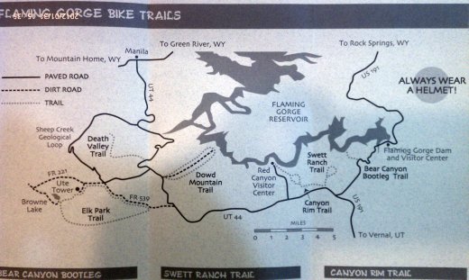
Bear Canyon Bootleg
Ability level- Easy
Description- Single-track trail offers views of Red Canyon and Flaming Gorge Reservoir from an overlook at trail's end. A short spur trail leads to Flaming Gorge Lodge
Swett Ranch Trail
Ability level- Moderate
Description- Double-track loop offers scenic views of Swett Ranch Historic Site(open to the public during summer), Flaming Gorge Reservoir, and Baretop Mountain. Watch for motor vehicles on the south section of this route.
Currant Creek Ranch Bike Trails
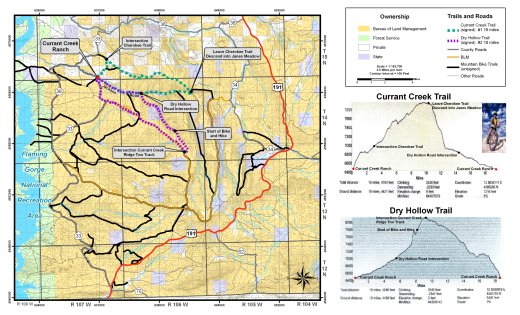 Riding along the BLM Wild Horse Loop, you're likely to encounter herds of wild horses grazing within feet of the trail. Up here in the high desert, bikers travel over rises only to stop in awe at herds of elk, deer and antelope spying their movements, examining their direction, then making a hasty retreat.
Riders can cross the desolate miles to ancient Indian Petroglyphs, with the eerie notion that inhabitants and hunters from hundreds of years past placed their artwork of wild animals for future generations to see.
The locals realize that the mountain biking potential in Sweetwater County is largely undiscovered, but this is changing fast. Two riders in the mountains around Jackson Hole were recently heard bragging about the superb riding trails located within a mile of Rock Springs.
Getting There
Take U.S. 191 south to County Rd. 33 Bike trail starts at Currant Creek Cattle Ranch.
Wilkins Peak
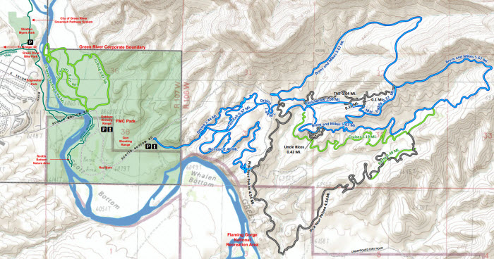 The closest starting point to the majority of trails system is just south-east of the City of Green River's shooting range off of Forest Road 171. To get to the main trail head you will turn off of East Teton, just north of Jackson Elementary, on to Scott's Bottom Road, cross the river bridge. The road makes a sweeping right turn and you will see a parking area next to the City's outdoor archery range Parking A.
You can choose to park there for a longer ride or to access the beginner/novice trails, Channel Surfing and 10 Ring or continue down the road to the Main Trail Head. The road turns to dirt just past Parking A. Take the left fork at the "Red Barn" and follow the road .5 miles. You will see a parking area, Parking B, and Info Kiosk on your right. This is the starting point of "Fast Exit". Depending upon your fitness level you may want to continue on Forest Road 171 another 2 miles to access the trails from the beginning of "Brent & Mikes Trail".
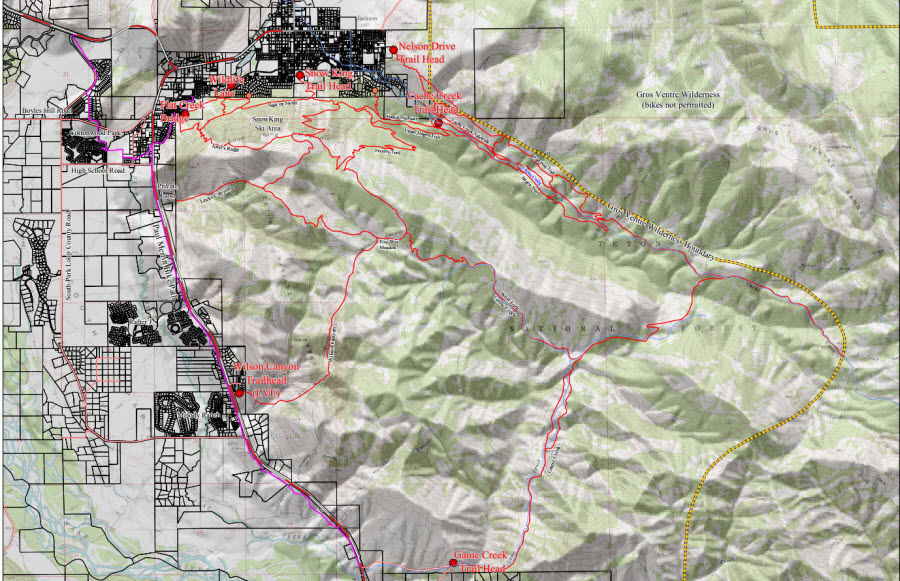
Jackson Pathways map
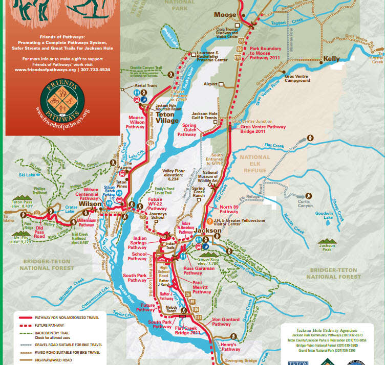 The award-winning Jackson Hole Community Pathways System continues to expand and now totals 33 miles. Many areas in the valley have excellent connectivity; and the smooth paved pathways serve a wide range of non-motorized interests from practical transportation to peaceful nature watching to joyful recreation
